 | |
|
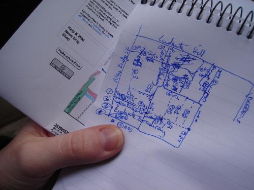
28 January 2007 Mapping LondonWe joined in the very well-attended OpenStreetMap London mapping party yesterday, and mapped fully - we think - the area south of St Pauls between Blackfriars Bridge and Southwark Bridge.
I'm not convinced we recorded all the one-way restrictions, but those can easily be added later. Multimap turned out to be excessively cool people for the support (and mugs!) they gave us. And the pub was a good occasion to chat and talk to a few OSMers I'd not met before - and, of course, get some Potlatch feedback. One UI suggestion was particularly helpful, not just for the idea, but especially because (while fixing it on the train home) I noticed and squashed a bug, while incidentally reduced the amount of data being shipped from the server to the SWF client. Which was nice. I do wish that we'd been able to use Potlatch to enter our weekend's mapping, though! Commentsdidn't get to speak to you in london, but i do like that logic diagram attribute collection method. i add a four-color pen to this technique for my rides here in brighton. Posted by Mikel on 29.1.07 12:19
Posted by Ninalhg on 12.2.07 03:33 |
SitesGeowiki PeopleEugene Baston ElsewhereBisbrooke Feeds
|
